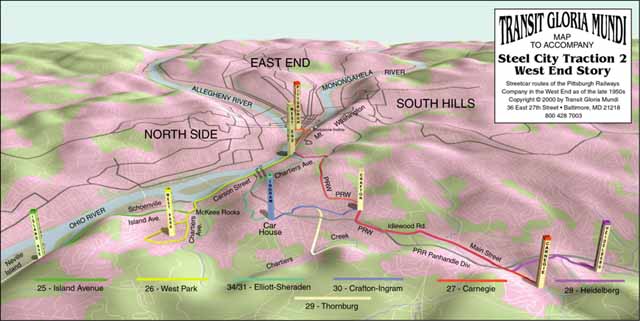
This map is looking due east. Click here for a larger version (70KB). It shows (in various colors) the routes that Pittsburgh Railways operated as of the late 1950s, which are the routes shown on the tape. Other PRC routes at the time are shown in black. A printed version of the map is included with the tape, or e-mail us and we will send you a copy by mail.
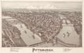
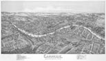
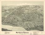
These are the panoramic maps from the Library of Congress which were used in the tape. Click on the thumbnail for a larger image (200K-300K each). Click the link below each image to be taken to the Library of Congress website, where the map may be viewed at a variety of magnifications. If you like this sort of thing as much as we do, you will probably want to check out the LC's Panoramic Map page.