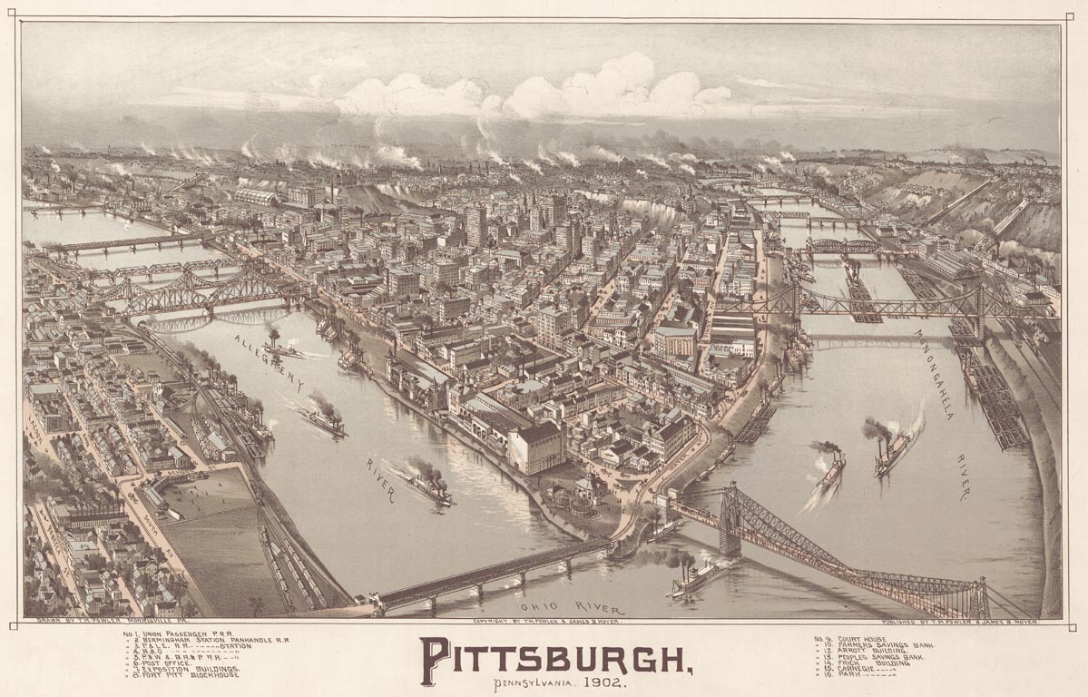
This 1902 view of Pittsburgh is looking due east. Point Bridge, which carried trolleys to the West End, is at the lower right. You can get a bigger, clearer view of this map at the Library of Congress website. It can also be downloaded in a special compressed format which requires a special viewer. Instructions on obtaining the viewer are available at the LC website.