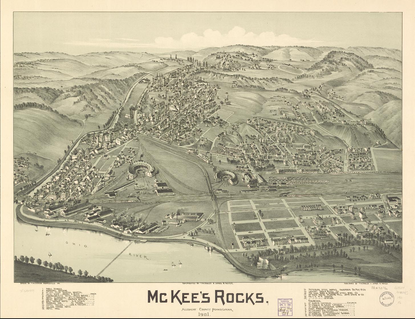
This 1901 view of McKees Rocks looks to the South. Just above the leftmost roundhouse is the junction where the tracks of the West Park route continue up Chartiers Avenue, and the tracks of the Island Avenue route branch off to the right. At the time of this map, the Island Avenue tracks turned off Island Avenue near the location of the Norwood Incline. The connection to Neville Island, Coraopolis and Sewickley was from the tracks which later became the Schoenville shuttle, visible starting at the bridge at the lower left, and winding to the right through the still undeveloped land which would become Presston. You can get a bigger, clearer view of this map at the Library of Congress website. It can also be downloaded in a special compressed format which requires a special viewer. Instructions on obtaining the viewer are available at the LC website.