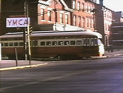
Steel City Traction 3
The North Side
These images, all frame captures from our master tape, take you on a condensed ride over Pittsburgh Railway's North Side Lines.
[Up]
[Main]
[ORDER]
[Sitemap]
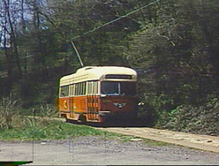
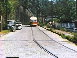
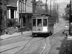
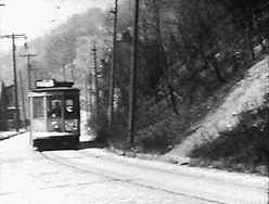
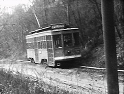
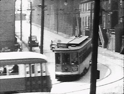
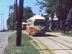
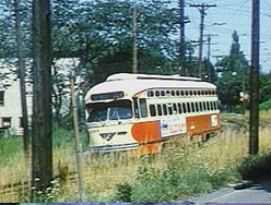
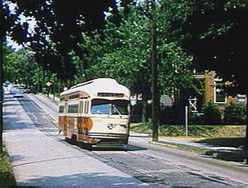
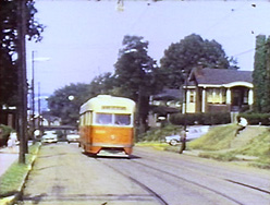
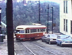
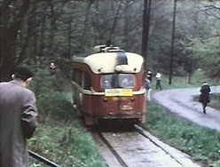
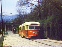 Route 21 Fineview begins its steep climb up Henderson Street, a nearly 15% grade, one of the steepest in the system. To the right of frame is the retaining wall atop which the Nunnery Hill Incline climbed until it was replaced by the Fineview trolley line in 1908.
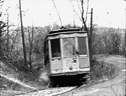
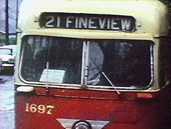
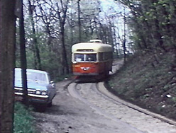
 Turning from Henderson into Carrie Street. Click here for a map of the Fineview line with street names. It will open up its own browser window, which you can make narrower to fit the map and keep open beside this page for orientation.
 Carrie into Warren.
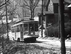
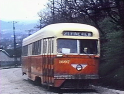
 At the point where Lanark becomes Biggs, just past the highest point on the line. Lanark Street was one of those unique Pittsburgh rights-of-way, a roadway laid down and maintained by Pittsburgh Railways in accordance with their franchise agreement, which required them to pave between the railheads, and as far outside the rails as the crossties extended. This type of construction was common in the West End, and occurred at several points on the Fineview line.
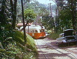
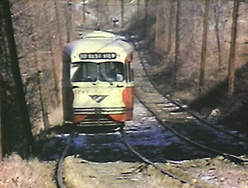
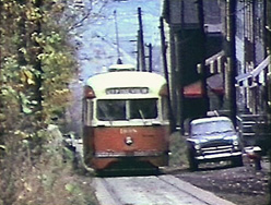
 On private right-of-way beside Glenrose Street.
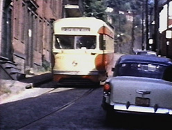
 Turning from Brule (formerly Bradford) onto Magnet.
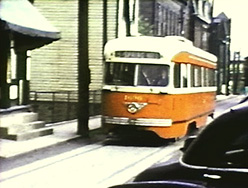
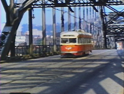
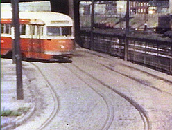
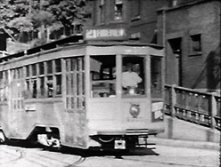
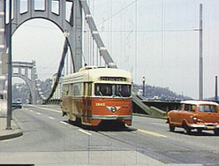 Entering downtown over the 9th Street Bridge. Until near the end of service, when a major construction project caused many diversions of North Side routes, 21 Fineview both entered and left downtown over the 6th Street Bridge. This bridge is one of the "Three Sisters" bridges, virtually identical spans carrying 6th, 7th, and 9th Streets across the Allegheny to the North Side.
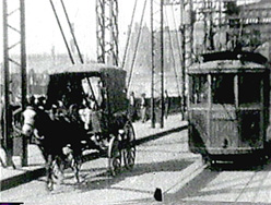
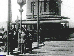 About 1904, a car turns from an earlier 6th Street Bridge onto Duquesne Way (now Fort Duquesne Boulevard).
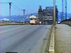
 Midway across the 6th Street Bridge. This bridge was moved to the downstream end of Neville Island when the replacement "Three Sisters" were built, where it continued to carry PRC trolleys to Coraopolis until 1952.
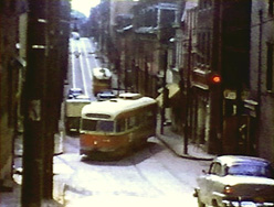
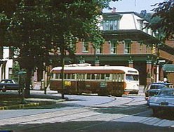
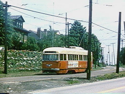
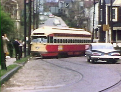
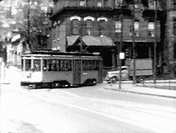 A Route 12 Evergreen trolley turning from North Avenue onto Sandusky.
 An outbound Route 5 Spring Hill car leaving the passing siding on Itin.
 An outbound charter enters the passing siding on Itin.
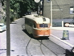
 Approaching the loop of the Spring Hill line.
 In pre-PCC days cars changed ends at Spring Hill.
 Inbound Route 5 car at the passing siding on Itin.
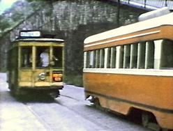
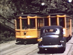 Two yellow cars pass on Itin, a favorite photo spot.
 Descending Itin inbound, just below the passing siding.
 Inbound at the foot of Itin, swinging right for clearance before making the left turn onto Chestnut.
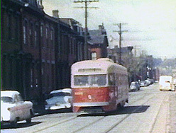
 An outbound Route 1 Spring Garden car turns through the hourglass junction from Chestnut onto Spring Garden Avenue. In the background, the inbound Route 5 car heads for the 17th Street Bridge.
 Inbound on Spring Garden.
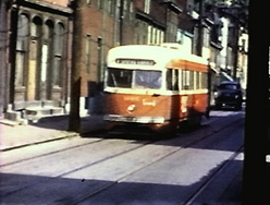
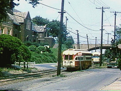
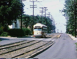
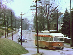
 An inbound Route 4 Troy Hill car on Lowrie at the beginning of double track.
 Inbound on 17th Street Bridge.
 Inbound on 17th Street Bridge.
 Inbound Route 18 Woods Run.
 Two closely-spaced 45 degree bends carry Route 18 from Columbus onto Sedgewick, fast beside the Pennsylvania Railroad tracks. This is a classic non-clearance curve.
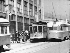
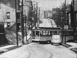
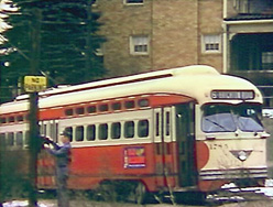
 A Route 22 Crosstown car leaves the layover point on North Avenue, turning into Sandusky.
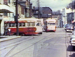
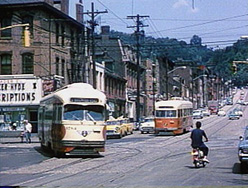
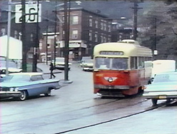
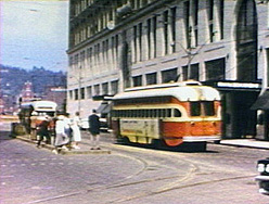 Downtown on Stanwix at Penn Avenue. The car on the right is on one of several North Side routes completing its downtown loop about to head for the 6th Street Bridge; the car on the left is a looping West End car.
 An outbound North Side car making a fast turn onto the 6the Street Bridge.
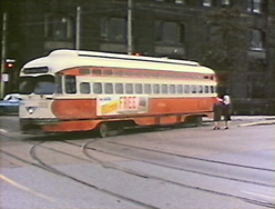
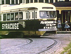
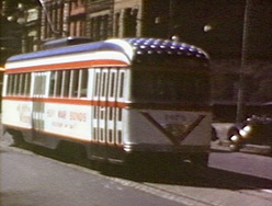 During World War II, the PRC gave many of its PCCs morale-boosting paint jobs. They usually ran on Route 22 Crosstown for maximum exposure.
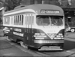 During World War II, the PRC gave many of its PCCs morale-boosting paint jobs. They usually ran on Route 22 Crosstown for maximum exposure.
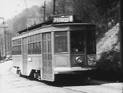
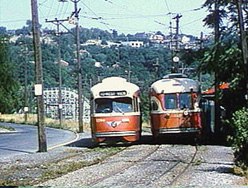
 Route 21 Fineview originally looped on the North Side rather than running through to downtown. Here a lowfloor Fineview car mixes it up with PCCs at one of the safety islands on Federal Street where passengers could transfer to and from the line. Click here for a map of the Fineview line. Click
here for a short downloadable movie of the Fineview line incorporating most of the shots from which the next 12 images were taken. Click
here for a map (140KB) showing where many of the shots were taken.
Or click here for a tall skinny map of the Fineview line with street names. It will open up its own browser window, which you can make narrower to fit the map and keep open beside this page for orientation.
Route 21 Fineview originally looped on the North Side rather than running through to downtown. Here a lowfloor Fineview car mixes it up with PCCs at one of the safety islands on Federal Street where passengers could transfer to and from the line. Click here for a map of the Fineview line. Click
here for a short downloadable movie of the Fineview line incorporating most of the shots from which the next 12 images were taken. Click
here for a map (140KB) showing where many of the shots were taken.
Or click here for a tall skinny map of the Fineview line with street names. It will open up its own browser window, which you can make narrower to fit the map and keep open beside this page for orientation.
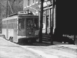
 A Fineview car at its North Side layover point at Anderson and Robinson, about to begin an outbound trip. We were lucky that Arthur Ellis decided to document Fineview during the war years before the conversion to PCC service.
 You call this a grade? On Federal Street, about to turn into Henderson and do some serious climbing.
 Climbing up Henderson, in approximately the same place as the first shot on this page. The grade varied from about 12% to nearly 15% between Federal Street and the summit. [Shown in the downloadable movie.]
 Same shot, a little later. [Shown in the downloadable movie.]
 The turn from Carrie onto Warren. [Shown in the downloadable movie.]
 Taking on passengers just before turning from Warren onto Catoma. [Shown in the downloadable movie.]
 Along Glenrose Street. [Shown in the downloadable movie.]
 The "Horseshoe Curve" from Glenrose onto Hazelton. [Shown in the downloadable movie.]
 Grinding up Bark (formerly Barnes) Avenue. [Shown in the downloadable movie.]
 At the layover point, on Charles ready to turn onto Perrysville Avenue. [Shown in the downloadable movie.]
 Inbound on Perrysville Ave. [Shown in the downloadable movie.]
 Inbound on Perrysville Ave. a rare color shot of a lowfloor car (made by Charlie Dengler). [Shown in the downloadable movie.]
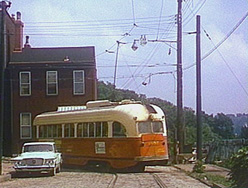
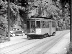
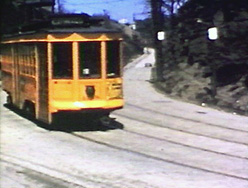
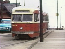
 An outbound Route 10 West View car approaching Keating carhouse at the beginning of a long stretch of private right-of-way.
 Outbound car at Keating carhouse.
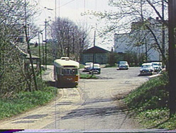
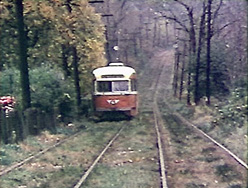
 Along the PRW to West View Park.
 Along the PRW to West View Park.
 Along the PRW to West View Park.
 Along the PRW to West View Park.
 Along the PRW to West View Park.
 Routes 10 West View and 15 Bellevue operated as a large bi-directional loop. At the West View Park layover point shown here, outbound Route 10 cars simply continued ahead, becoming inbound Route 15 cars, and vice-versa.
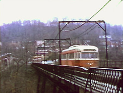
 The Center Avenue high bridge.
 Forest Avenue.
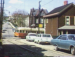
 Balph Avenue, approaching California Avenue and the junction with the 13 and 14 lines.
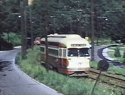
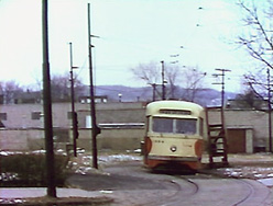 The Emsworth loop. Note the platform to the right of the car, for operators to install or adjust sleetcutters on the trolley poles.
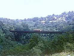
 Route 13 inbound over the Lowries Run bridge.
 13 inbound on Church Avenue.
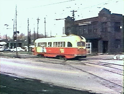
 Inbound along California Avenue.
 A West View car inbound over the private right-of-way between Keating Carhouse and Perrysville Avenue.
 A route 6 Brighton Road car on layover at the outer terminal just off California Avenue. The operator is signalling his departure with the transmitter mounted on the pole beside the car. A record of the time of his transmission will be printed out almost immediately at the central Traffic Dispatcher's office, and combined with other transmissions from intermediate points, allows the dispatcher to correct irregularities in the service.
 The hourglass junction at California Avenue and Brighton Road. An inbound route 6 Brighton Road car is being aced out by the route 15 Bellevue car turning off California Avenue.
 An inbound car (route 6, 13, 14, or 15) turning from Monterey onto West North Avenue.
 An inbound route 6 Brighton Road car turning from West North Avenue onto Federal Street. In the background on Federal, an inbound route 21 Fineview car waits.
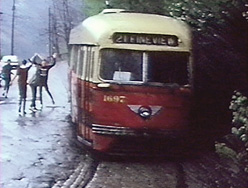
 Some shots on route 21 Fineview on the last day of service.
 Going up Henderson Street.
 Turning from Henderson onto Carrie Street.
 Carrie onto Warren.
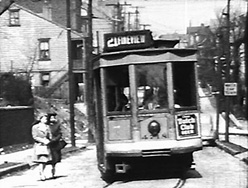
 On Catoma about to turn into Lanark Street.
 Ascending Lanark.
 Along Biggs, about to turn into Glenrose.
 Inching down Brule (formerly Bradford) approaching Magnet Street.
 On Magnet about to turn onto Hazelton. (Hazelton is discontinuous, and the Fineview line occupies two disconnected stretches of it.)
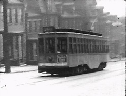
 Descending Perrysville Avenue.
 A fantrip car turning from Warren onto Catoma.
[Up]
[Main]
[ORDER]
[Sitemap]