Steel City Traction 2
West End Story
These images, all frame captures from our master tape, take you on a condensed ride over Pittsburgh Railway's West End trolley lines during their last years of operation, ending in 1959.
[Up]
[Main]
[ORDER]
[Sitemap]
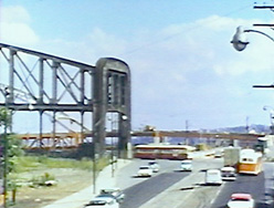
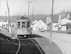
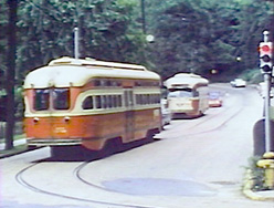
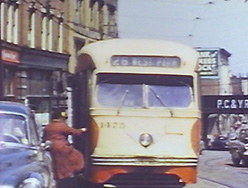
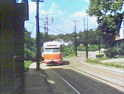
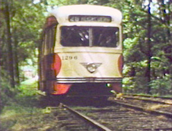
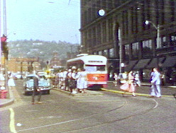
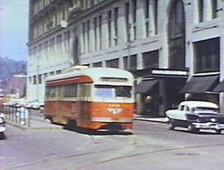 Stanwix at Penn Avenue, ready to start the journey.
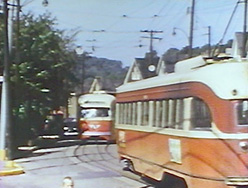
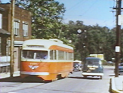
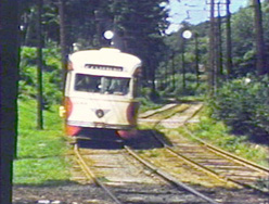
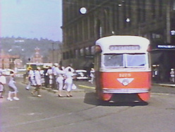 Rush hour at Stanwix Street and Penn Avenue on the downtown loop. Our cameramen catch outbound cars on 5 of the 6 lines making the turn onto Penn.
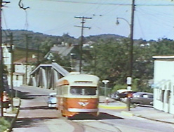
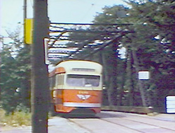
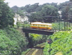
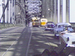
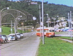
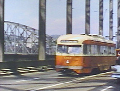 On Point Bridge
 Trackage along Carson Street between the Smithfield Bridge and Point Bridge carried the cars of Route 32 - Pittsburgh & Lake Erie Transfer until June, 1953. The track was closed permanently in 1956, leaving the Point Bridge tracks as the only connection between the West End and the rest of the system.
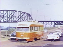
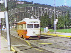
 Ft. Pitt Bridge was nearly complete in 1958. It still carries the bus lines which replaced the streetcars on June 20th, 1959. Although closed in 1959, Point Bridge wasn't demolished until 1970.
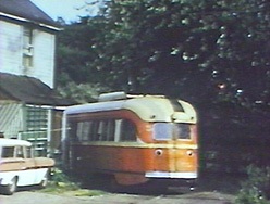
To the left of the vacant lot was once a car house of the Pittsburgh & West End Railway, one of the predecessors of Pittsburgh Railways.
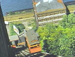 The Duquesne incline is still in operation. At the time these films were shot, it connected the West End lines at the bottom with Route 40 - Mt. Washington cars at the top.
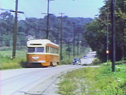
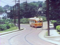
 At McGann's Corner, Routes 27, 28, and 30 turned off Wabash onto private right of way closely paralleling Noblestown Road up to Crafton Junction. This trackage was originally operated by the Pittsburgh, Crafton & Mansfield Street Railway.
 Leaving private right-of-way beside the Panhandle Division of the Pennsylvania Railroad, about to turn and pass under the railroad.
 After crossing underneath the Panhandle, the tracks turn to form Idlewood Road. This unusual right of way, unique to Pittsburgh, is a roadway laid down and maintained by Pittsburgh Railways in accordance with their franchise agreement, which required them to pave between the railheads, and as far outside the rails as the crossties extended. Most municipalities took it from there, adding at least a curb lane and a curb. But some didn't feel the extra investment was necessary...
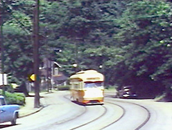
 Idlewood Road
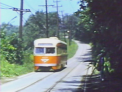 Idlewood Road
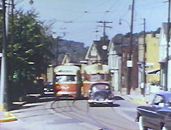
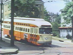
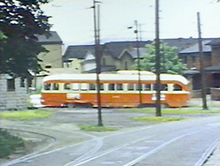
 The Carnegie loop was at 9th and Main.
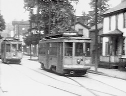
 Near the end of service, Heidelberg was the only major West End route with a considerable stretch of single track with passing sidings.
 On Carothers Avenue.
 On Carothers Avenue.
 Route 28 was originally operated as a shuttle between Carnegie and Heidelberg, using double-ended low-floor cars.
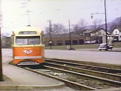
 A loop was installed here at Heidelberg in 1945 to accomodate PCC cars when the decision was made to operate it as a through route to downtown.
 An inbound car about to turn onto Carothers.
 This is Black's Bridge, crossing over the Panhandle Division.
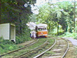
 An inbound car at Crafton Junction.
 An outbound Route 30 - Crafton-Ingram car has just turned from Noble Avenue onto Steuben. This was formerly the junction point with Route 29 - Thornburg.
 On Center, approaching the next crossing of the Panhandle.
 An inbound route 34/31 Elliott-Sheraden car turning from Jeffers into Chartiers Avenue.
 The next leg of our trip takes us farther out Carson Street to McKees Rocks.
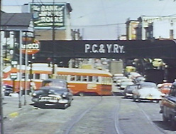
 The junction at Chartiers Avenue and Island Avenue was sheltered by the Pittsburgh, Chartiers & Youghiogheny overpass, visible in the background. The PC&Y was a freight connection railroad owned jointly by the Pennsy and the Pittsburgh & Lake Erie.
 At Fleming Park loop, terminus of route 25 - Island Avenue, in 1958 there were still traces of the tracks that continued out to Neville Island, Coraopolis, and Sewickley.
 On Neville Island. Route 23 was cut back from Sewickley to Neville Island in 1952. It was replaced by a bus route in 1953.
 Island Avenue inbound. The land here had been gradually sliding down into the Ohio River valley for several years.
 An inbound 25 - Island Avenue car at the junction with the 25 - West Park line, at the PC&Y underpass.
 Outbound 34/31 - Elliott-Sheraden car on Chartiers Avenue.
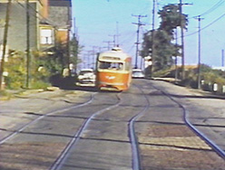
 On Ladoga Avenue, another of the streets consisting only of the paving covering the trolley tracks.
 On Ladoga approaching Ingram carhouse.
 Crossing over the Panhandle Division.
 On Center approaching Hodgson.
 Approaching the junction with the Thornburg shuttle.
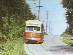
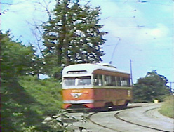
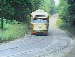
 Inbound on the private right-of-way paralleling Noblestown Road.
 Inbound on the private right-of-way paralleling Noblestown Road.
 Inbound on the private right-of-way paralleling Noblestown Road.
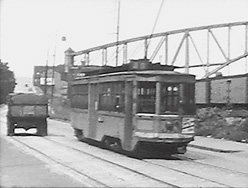
 Inbound on the Point Bridge.
 Inbound on Penn Avenue, Point Bridge in the background.
 Turning from Commonwealth onto private right-of-way paralleling Fort Duquesne Boulevard, part of the downtown loop.
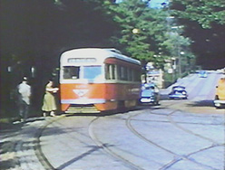
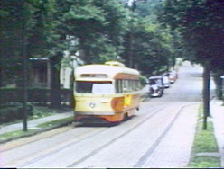
 On Stanwix, ready to start an outbound trip.
[Up]
[Main]
[ORDER]
[Sitemap]